Saturday, August 4, 2012

Day 7: Last day on the BRP

One thing that is especially nice every day is to put on a clean jersey and shorts.  I end every day by washing up, then cleaning my ONE and only jersey and ONE and only pair of cycling shorts, then hanging them to dry overnight.  Remember that storm last night?  Guess where my clothes were?  I slipped into my wet didies at 6 and slopped out of the mudfest.  The rain had basically stopped by then and I had no reason to sitck around.  I wanted to get to a hotel tonight.

Otter Creek campground is mile 65 on the Parkway.  Matthew and Vanessa had warned me about today.  It's the desert.  Only one place to stop for water and nothing else until I get to milepost 0 at Rockfish Gap and the city of Waynesboro.  I saw basically nothing of interest and no one until I got the the one water stop at Whetstone Ridge Picnic Area at milepost 29.  

Then I bumped into Jim Vreeland.  I was sitting at a picnic table finishing off my "lunch" when an animal with thighs that would make Arnold jealous rolled in on a racing bike.  I figured he was out for a day ride and asked him where he had started.  he told me Peaks of Otter (where I had lunch the day before) milepost 80.  "Good ride" I said, "turning around here?"  Nope.  he was headed for Rockfish Gap.  Turns out Jim was riding the entire BRP.  He had started in Cherokee, NC at the other end on Monday, the day after I had left from Ashville, and was about to pass me, after giving me a 90 mile head start.  On that first day, he climbed Mt. Pisgah, the highest point on the Parkway, then passed Ashville and climbed Mt. Mitchell, north of Ashville, the highest mountain east of the Mississippi!  It put things in a new perspective for me.  If he could do 80 miles a day average, I could do 60.

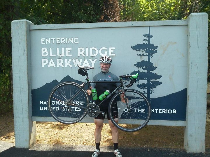
Jim was the kind of guy I like meeting on tour.  Great guy, you could tell he just wanted to have a great time.  He and I played cat and mouse for the last 30 miles....well, he played it.  There's no way I could keep up with him.  I think he let me catch up a few times just to boost my ego.  when we got to Milepost 0 (well, he had been there a while waiting for his wife) he took a photo of me in front of the signpost to mark the end of that part of my ride and graciously offered to drive me back up from town the next morning, as he was staying in Waynesboro tonight also.

I was going to need that ride the next morning.  My hotel was 6 miles DOWN from the Parkway.  I hit the showers, then the CVS across the street.  I needed food and Flex-all for my aching knees.  I had checked Google in advance and chose this hotel because it was walking distance from St. John the Evangelist Catholic Church, and this was my only chance to go to mass.  Now, understand this;  I packed light for this trip.  Really light.  One of everything I needed and nothing I didn't need.  I had one pair of cycling sandals, which I was wearing.  I had one clean polo shirt which I was wearing.  I had one pair of clean shorts.  I had no belt, my shorts were kept up with about 11 inches of nylon twine.  This isn't exactly the way I normally dress for church.  I had planned on skulking in and hiding in the back row, hopefully unnoticed.  I got to church about 25 minutes early...and the place was mostly full already.  By 4:45 the place was packed and mass didn't start for 15 minutes.  By 5, it was standing room only and I was shoulder to shoulder with hundreds of properly dressed catholics.  so much for hiding.  They probably thought I was a homeless person.


After about an hour riding, I had climbed 1700 feet.  BTW, the locals pronounce it Byoona Vista.  No place to get off here to eat.  It would add about 10 miles to the trip to do so.

YAAAY!  My first turtle rescue of the trip.  This is a badge of honor to cycle tourists, to save a turtle crossing the road from turning into a pizza.

Look at his eyes.  you've seen that look before.  Remember the hyenas in "The Lion King?"  Half crazed predators.  That's Jim.  It takes a madman to crank out the kind of ride he's doing.  Oh sure, he has a wife and kids, but don't kid yourself.
While toying with me, Jim took this shot of my backside (one of the few times he was behind me).


I'm abut 5 miles from Rockfish Gap and I'm still 3000 feet up.  it's either going to be another screaming descent to milepost 0, or I'm gonna have a heck of a ride down to town.


390 miles down, 105 to go.
From Jim's Facebook page:  "DONE!! Just about 500 miles and a tad over 50,000 feet of climbing in 6 days. Epic trip, highly recommend it."
Look at his front chainrings.  Looks like a medium deep dish from Godfather's.


My lovely hotel room.  Nothing but the finest brickwork.  Chime in and don't forget to phrase your response in the form of a question.

64 miles today.

399 miles total, so far.

Day 6: Up...and I don't mean the movie

On my first day, in Ashville, I was looking for an IHOP for breakfast.  I settled for a Waffle House because it was so close to my folks' hotel and spitting distance from the Parkway.  Today, however, I got my wish.  a scant 5 minute walk from the hotel was an IHOP, open 24 hours.  Breakfast this morning was at 6:30, as I wanted to be on the road before 8:00 again.  I had looked at the elevation profile for the day and knew I had a lot of climbing to do today, so I planned on a big breakfast.  I had no idea what I was in for.  I ordered a "Colorado Omelette" with a side of sausage links.  HOLY SMOKES!  The omelette was a big as my arm!  I needed the calories, but it was tough going.  I waddled out of the restaurant.

Today I had some mountains ahead of me.  I started out at the Roanoke River...you know river BASIN, to tell you how low I started.  I had to climb Apple Orchard Mountain which truly SUCKED EGGS! and in between those two climbs, 2 more big hills.  Despite my big breakfast, I was going to need a serious refuel mid-day.  I thought I had struck out again when I reached Peaks of Otter.  The first thing I came upon was the picnic area and gift shop.  I couldn't even score pork rinds there.  I sat down and had some of my road chow when the woman running the shop came out to talk.  There's a a WHAT 1/4 of a mile up the road?  A real RESTAURANT!  Peaks of Otter has a lodge (Which I knew) and an excellent restaurant.  For under $10 I had a meal to get me over the mountain!!!

Did I mention that Apple Orchard mountain sucked?  Really, it did.  That sucker was just plain IN MY WAY.  6+ miles of just pokie, poke,poke.  Oh sure, sounds real nice;  Apple Orchard.  Probably going to have a pleasant view of fruit trees all the way up, maybe a snack bar serving pies, apple butter and the like at the top.  NO!  Just mile after mile of hills.  the only saving grace was the fact that I was climbing the mountain the 'easy way."  The other side was less steep, but was 13 miles long.

On the way down, I passed my second pair of tourists.  Mike and Jim had started 2 days earlier at mile 0 of the Parkway and were on their way to Peaks of Otter for the night.  They had climbed 7 miles up Apple Orchard mountain and still had 6 more miles to go.  They looked glad for a break to talk.  Again, it was great to talk shop with them and swap stories.  They were also surprised at how few people they had seen and how vacant the campgrounds were.

I reached my lowest point today....twice.  First was the base of Apple Orchard mountain.  The James River was the lowest elevation on the parkway, at 650 feet.  Three lousy digits..6..5..0.  That only means one thing, I gotta climb back up out of there again tomorrow.  My campsite was just past the James River at Otter Creek campsite and Restaurant.  Charlie and Elizabeth were wrong again.  The restaurant closed 2 years ago....(sigh).  When I checked in, I asked for a weather forecast and was told there was a slight chance of rain.  She also said that such a forcast usually meant a sprinkle and it was only when they said rain that you took cover.  I set up my tent without the rainfly.  Then I heard the thunder in the distance.  I put on the rainfly, hoping the humidity would go away...which it didn't.

Around 11:00 at night...KABOOOM!!!!  Thunder, rain, winds, locust, frogs, the creek turned to blood.  My second low point of the day.  Somehow I had displeased God and he was letting me know.  The rain was so hard, it bounced off the ground under my rainfly.  I lay quivering in my tent wishing the ride was over and I could be in my nice warm DRY bed next to my wife.  I think I got 4 hours of sleep that night.


The Roanoke River.  It's uphill from here.

A couple of thousand feet higher, I passed this cliff face, next to the road.  That's sedimentary rock.  I'm looking at the seabed from millions of years ago, turned on it's side.

Just north of Roanoke, I passed the Applachian Trail for the first time.  It'll be criss-crossing the Parkway and Skyline Drive for the rest of this trip.  I don't expect to see any thru-hikers this late.  Most of them start in Georgia in March.  If you haven't passed here by now, in August, you won't make it to Maine before the snow.

Punch-Buggy Red.  The lady running the gift shop at Peaks of Otter drives this and is a transplant from the DC area.  She retired here because it's beautiful and cheaper to live here.

Peaks of Otter restaurant, right next to the Parkway.  Excellent vittles.

The lodge.  Would have been a great place to stay the night, but would have made the next day an 80 mile ride.  

Near the top of Apple Orchard Mountain.  I think it's an alien spacecraft.

Well if you're going to call it that, the least you could do is plant a few @$%&*! apple trees!

Mike (left) and Tim (right).  Sort of like Penn and Teller without the magic.  Mike did all of the talking while Tim did a lot of nodding.  Check out all of the gear.  Makes me look like a wuss.


Just a pinch under 63 miles for the day, and a pinch under 10MPH average.

335 miles down.

I took my hub apart to look for the percussion section that has been along for the ride.  It's not supposed to come apart this easily without a mallet.  The sealed cartridge bearings on one side got catty-wumpus on me somehow and wore a groove in the hub shell.  I cleaned out some aluminum shavings and hoped for the best.  It probably will make it the rest of the way, just with a little noise.

It looks so peacful...for now.

Thursday, August 2, 2012

Day 5: Going strong...good food helps

Relatively speaking, I got a late start today, at 7:45.  My first stop of the day was breakfast at Mabry Mill which I _KNEW_ was actually there because I had called the night before to see what time they opened.  Mabry Mill is an old grist mill and the most photographed site on the parkway.  I have heard that other states use images of the mill on their postcards because it is so photogenic.  There is a restaurant there, more to the point.  The french couple from the previous day raved about the food, including the crepes.  Let's face it, if a guy from France likes the crepes, the food has to be good...right.  YES.  It was only a 2 mile ride from Meadows of Dan and I got there at opening as their first customer.  Nice place, sign by the door requiring shirt and shoes.  They didn't blink at the sight of me in cycling clothes, it's a common stop for the tourists.  The food was excellent, the serivce was great and the tab was cheap.  If you're in the 'hood eat there.

I fully loaded up my belly, not expecting a place to stop for lunch again and was out of there by 8:45.  I planned on learning from yesterdays' bonk and take frequent breaks today, whether I needed them or not.  God was listening to my requests today.  When I needed a break, I found a shady spot.  When I needed water, I found a picnic area.  When I needed food...well, 2 out of three isn't bad.  Another day of macadamia nuts and pepperoni.  I gotta find some cheese in town tonight.  God also provided a rhythm section today.  About mid day I started hearing a clicking noise from the front wheel.  I stopped,  took the wheel off checked it...seemed fine.  Smooth bearings, no play.  Beats me???

Passed 3 neat places today, as well.  First was the Chateau Morrisette Winery.  My wife and I are very fond of their wines, having found them at the Virginia Wine Festival a few years back.  Their labels include a picture of a labradore retriever and when we adopted our yellow lab, Quita, 9 years ago, we gave her original owner a bottle of their wine as a thank you gesture.  I didn't stop there because it was a good 5 miles off the beaten path and it was only about 9 in the morning.  What would I do at that hour?  Buy a case of wine to take with me?

Next was a hillside with a huge treble clef sign made out of shrubbery.  My first guess was some sort of band camp.  I did a google search later on and found out it was the site of a music festival held every year.  I missed out on FloydFest by about a week this year.

Lastly, was a beautiful cathedral right on the parkway.  Around noon I could hear the bells tolling (which I first mistook for yet another noise from my bike).  That turned out to be the Syon Abbey in Copper Hill, VA.  A reminder to me that I needed to go to church Saturday night, lest Father Dan refuse me communion in the future.

I had a couple of "hills" to climb that day.  Inspired, I started singing "Climb Every Mountain" from the sound of music...at least the words I could remember.  I decided that what I needed tonight was a good steak house with a good bar.  God listened.  After my last hill, I had a blistering decent into Roanoke for about 6 SCREAMING miles.  It was a blast.  I arrived at my hotel feeling like the king of the mountain (ignoring the fact that I would have to poke my way back up the the Parkway the next morning).  And wouldn't you know it;  right next to the hotel was a steakhouse  :)

One last bit of business before my steak dinner (and a manhattan). I did a google search for an ABC store and a department store.  Found both about 2 miles away.  After a shower, I stripped the bike of the bags and ran out for some more miniatures to ease the pain in the evenings from the ABC store and detergent, cheese sticks and fuel from K-Mart.  Tack on another 4 miles for the day.


This is the view of Mabry Mill that you see on every BRP website in the known blogosphere.  In addition to the mill, there is a blacksmith shop that is still in use as part of the park system.

This is the site you don't see, the restaurant.  Odd, because it's what everyone talks about.  No one says 'Oh, you MUST see the blacksmith shop!"

The grounds for FloydFest.  No, not Pink Floyd.  More like country/bluegrass/folk music.

Apparently, some of the old log cabins were put to use again when the CCC built the BRP back in the 30's.  

This one looks more like a stable than a cabin, now.

The Syon Abbey.  Syon is an old spelling of Zion, referring to Jerusalem..or is it the last refuge of man from the machines in "The Matrix?"

Wallpaper shot of the day.  First time I've had a vista in 2 days.


Darn!  The only non-smoking room on the ground floor they could get me was with a king size bed :)  Did I mention that God was providing for me today?


39 MPH average, 272 miles traveled so far.
59 miles on the odometer today, but you can add 4 more for the booze run.


Wednesday, August 1, 2012

Day 4: It's really just another road

I woke up at 5:30 to a scraping sound.  Not loud enough to be a bear or a racoon, so I figure there was a bug scratching on my tent, maybe a mouse.  I kept swatting at the top of the tent to scare it away, but no good.  Really??  I got out of the tent and found nothing (fine with me).  As I was packing my gear, I discovered the culprit.  it was my air matress.  I took the lightest one I had, which was plastic, laminated over the foam core.  The plastic was coming delaminated and had created an expanding bubble/blister about the size of a basketball.  As it expanded, it would creak and make the scratching sound.  This could be a problem.


The ride for the day was light rolling hills (65 miles of them) through farms and residential areas.  I knew I was still over 3200 feet up, but you'd never know it.  No overlooks for most of the day, no vistas, no mountain scenes....just a road going up and down and up and down.

In keeping with the pattern of not finding stuff that was supposed to be there, I could not find the Inn of the Red Thread, Bits and Pieces Grocery had closed, Felt's Bros. Market was 5 MILES off the parkway...etc. etc. etc.  I did pass a campground with a camp store near Fancy Gap, but didn't stop.  That turned out to be a mistake that I would regret.

Mid day, I passed my first cycle trourists of the trip  :)  Matthew was from France and had come over to ride the BRP from end to end, north to south, with Vanessa, from Quebec.  They came loaded for anything.  They had front and rear panniers on their bikes and told me that they were each carrying 4 liters of water.  Mathew had broken down somewhere along the line and was even carrying his original rear wheel on his rear rack! They were stealth camping and asked for a place to stay near the Northwest Trading Post, their goal for the day.  I told them that there was supposed to be a place called Raccoon Holler, but dont' hold your breath.  They warned me that the first 60 miles of the BRP were a desert, with only one place to get water, thus the reason they carried so much with them.  it was great to finally get to talk shop with someone and they impressed me with all that they carried.  Easily 50 pound each.

After about 50 miles of solid, non-stop riding, I had pushed myself too far.  I ran out of gas and had to pull over.  I had bonked for the first time on this ride.  I had figured that it would be an easy day, just rolling hills, no real mountains to climb today, but I got snookered into pushing myself too hard.  I still had 10 more miles to go and was getting worried.  I dug into my snacks and sat on the roadside for about 30 minutes.

According to my cheatsheet, the Mayberry Trading Post was just up ahead.  I had seen pictures of it, and was optimistic that it would actually BE THERE.  I got lucky...sort of.  It was there, but similar to the Northwest Trading Post, more of a nick-nack place.  Once again, my snack was pork rinds and a soda.  I figured a Dr. Pepper might have enough caffine to give me a boost to make it to The Meadows of Dan, my final destination.

I made it by about 4:00, the latest arrival so far.  The Meadows of Dan is a private campground and is...interesting.  The "office" is the kitchen table of the owners/managers house, on the road before the campground.  I knew this in advance, because I had read about it from other people's reviews.  If I hadn't known, I would have just wandered around looking forever.  I ws told to pick any tent site i wanted, because I was the only one.  the good thing was, each campsite had an electrical outlet, so I could charge my phone and use it without killing the battery.  The comfort station (bathroom) had showers, unlike the park campsites, and soda machines.  The bad news, I was going to be alone in a pretty shabby looking site.  If it rained, I was guaranteed to be covered in mud the next morning.

As I had come in, I passed cabins, which I knew were there.  Executive decision time.  I called the "office" and made an upgrade.  One of my smarter moments.  After today's ride, I deserved a nice bed and some A/C.


Around 7:00 am.  you can see the clouds spilling over the mountains as I left my campsite.

Crossing over the state line from NC to VA....literally a LINE.

Matthew, from France, and Vanessa, from Quebec.  I didn't bother asking why he made the trip.  DUH!

I am still up in the mountains, but I never saw them.

One reason I didnt' stop to rest today is that there was so little to stop for.  One of the few places along the way.  Another frontier homestead. 

No, my camera isn't crooked.  The building was built on a hill and had shifted over time.  Inside were signs saying "we love Andy Griffith" and pictures of him and Don Knotts.

Very nice cabins at MoD.  Worth every penny.

Complete with a kitchen and a TV that picked up 4 or 5 stations.

I was too tired to sit on the swing on the porch.  I let my jersey ride there as it dried overnight.
Coy pond at the entrance Meadows of Dan Campground.  there was a sign saying "Catch and release."
62 LOOOONG miles today

213 miles, so far


Day 3: A walk in the clouds...er,bike

I had set the alarm clock to 6:30, hoping to be on the road by 8:00 a.m. at the latest.  I woke up and couldn't get the alarm to stop....because it was a fire alarm!  Someone had burned their toast at the breakfast nook in the lobby and set off the smoke detectors.
I did manage to hit the road, and started off the morning in fog, for about an hour.  No, not because I was sleepy, because I'm still at about 4000 ft. elevation.  The clouds stuck with me most of the day, which was fine until it started to rain on me, about 5 miles before I made it to the campground.  I pulled over at the Doughton Park "Restaurant" and kefetched about my out of date information about this trip.  I had read a number of journals on the "CrazyGuyOnABike website and read the book, "Bicycling the Blue Ridge Parkway" by Charlie and Elizabeth Skinner to prepare my crib sheets for the ride.  Each day, I would put a laminated sheet in my back pocket with all of the waypoints for the day where I could stop for water, food, lodging, etc.  According to today's sheet, I should find food at several places today.  The Northwest Trading Post, in Laurel Springs, at rt. 18 and at this restaurant.  Nope.  The Northwest Trading post is a nick-nack store.  I would have been fine if I needed a quilt, or a birdhouse.  Otherwise, I had a choice of candybars, fudge or peach preserves for lunch.  The stores on rt. 18 were closed.  The restaurant in Doughton Park closed 2 years ago.  Today, I ate the pepperoni and macadamia nuts in my bags.
Doughton Park wasn't quite as nice as Crabtree Falls had been, but there were a few people there to talk to this night. On the other side of the loop was a young couple, one a teacher, the other a counselor, both from Florida, on vacation.  They asked the "usual questions" about my ride and were good to talk to.  At night, he pulled out his guitar and was playing when I went to sleep.  Not a bad way to end the day, especially since it stopped raining on me by then.  Dinner could have been tragic.  I pulled out my beef and zucchinni cassarole to rehydrate in my pot, and in a serious brain-fart move, dumped half of my bottle of cooking fuel into the pot!  Not only did I ruin the food, I lost a couple of days worth of fuel and things didn't look too good for finding fuel until I reach Roanoke in a couple of days.


The fog kept rolling in down from the mountains all morning.

A neat log cabin in Doughton Park.  The "park" is really just a large forest with trails running through it.  The campground is the only place where you will find much of anything.

it may be a well, or an outhouse.  I prefer to think of it as the "mother-in-law's house" from pioneer days.

The best I could find in the way of food today, thanks to the Northwest Trading Post.


NO FOOD here!!

I saw several wooly bears on this trip.  I think this means a warm winter.

Don't believe the map.  There is no restaurant, nor a gas station.

Still keeping a 10MPH average.  In the mountains, I'll take it.  55 miles today.

Top speed for the day: 43 MPH...HOT DIGGITY!

No bear box at the campsite.  Instead, I hung my food on a pole above the table.  Now really, what bear couldn't get to THAT?